Chinese
 Spanish
 Russian
 Portuguese
 French
 German
 Indonesian
 Thai
Thai Vietnamese
 Arabic
 Italian
 Turkish
 Polish
 Japanese
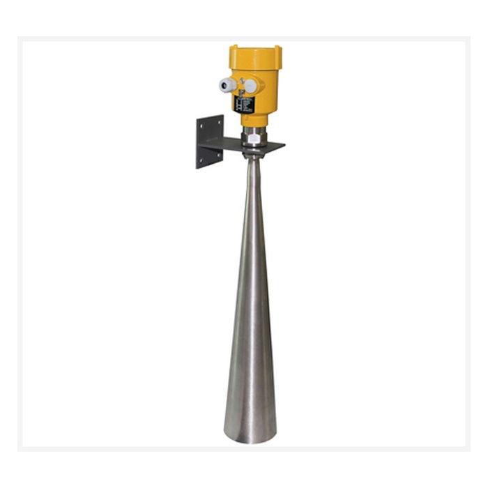

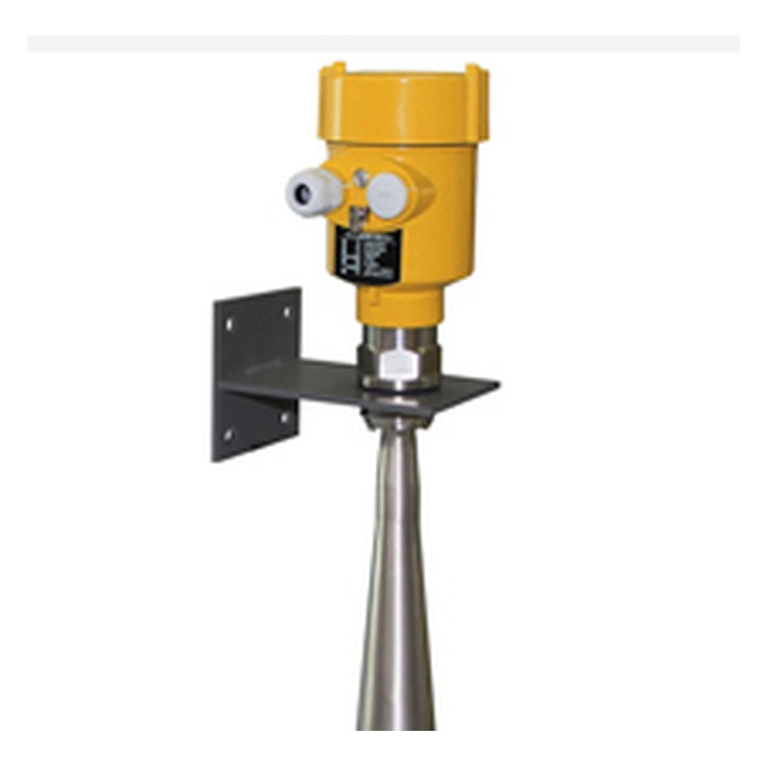
selection summary
It is used for long-range non-contact water level monitoring in rivers, lakes and shoals, with a reference range of 0-70m and an accuracy of ±10mm. It supports thread, bracket or flange installation. Before ordering, you must also confirm the installation elevation, maximum and minimum water levels, protection, brackets, power supply and communication, lightning protection and whether flow calculation is required.
Product overview
MV-RD909 long-range 26 GHz radar water level meter is used for non-contact continuous water level measurement in open water bodies or municipal water scenes. The meter outputs distance or water level, which can be used for real-time monitoring, over-limit alarm and change trend analysis; it is not a radar flowmeter that alone completes flow calculation.
Measurement principle
The 26 GHz radar pulse is emitted from the installation point and receives the water surface echo. The air height is calculated based on the propagation time, and then the water level is converted from the installation base elevation. The 70m reference range is suitable for sites with large installation distances or large water level changes.
Usage scenarios
- Long-distance continuous monitoring of water levels in rivers, lakes and shoals.
- A non-contact water level measuring point with a large distance from the installation point to the lowest water surface.
- During the flood period, the water level changes in a large range, and a larger range margin needs to be reserved for the site.
- Hydrological stations that need to upload water levels, change rates and alarms through RTU and data acquisition gateways.
Value applied to procurement and technicians
Technical parameters
| Typical applications | Rivers, lakes, shoals and long-distance water level measuring points |
|---|---|
| Measuring range | 0-70m |
| Measurement accuracy | ±10mm |
| Working frequency | 26 GHz |
| process connection | G1½A or 1½NPT thread, bracket or flange |
| process temperature | -40~100℃ |
| process pressure | normal pressure |
| Protection level | IP65 or IP67, depending on housing and complete configuration |
| Shell | Cast aluminum or plastic |
| Electricity | RS485 type DC6-24V; 4-20mA/HART type DC24V |
| Signal output | RS485 Modbus or 4-20mA/HART |
| Measurement interval | About 1 second, changes with parameter settings |
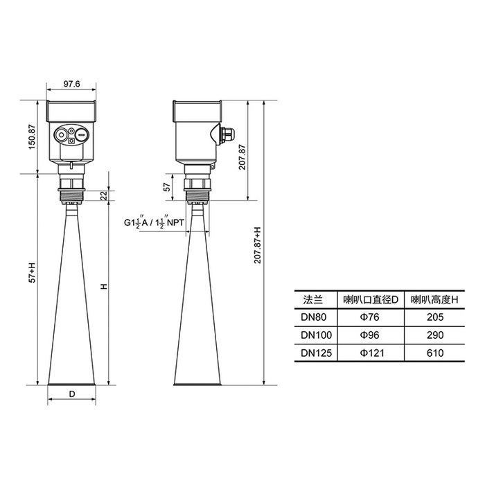
Description: The page parameters are used for inquiry and preliminary selection. The range, accuracy, protection, housing, power supply and output need to be confirmed according to the complete model combination. The upper limits of different configurations cannot be used at the same time by default.
Selection guide
- The range is selected based on the distance from the radar datum to the lowest possible water surface, taking into account bridge elevation, flood level and installation allowance.
- Provide section, pier, bank slope, wave and water surface reflection conditions to confirm that there is no obstruction in the beam for a long time.
- Select threaded, bracket or flange connection according to bracket stiffness, maintenance conditions and antenna size.
- For long-distance measuring points, the antenna direction, fixed echo and target water surface area should be checked, and not just the 70m number.
- Confirm IP65 or IP67 enclosure, outdoor lightning protection, power supply, communication and low temperature environment requirements.
- Flow applications need to establish a separate water level-flow relationship. When backwater is obvious, the flow rate should be increased or the upstream and downstream water levels should be measured.
Key points for installation and commissioning
- The bracket should resist wind and vibration and facilitate the verification of the antenna direction. The long cantilever structure needs to be confirmed for mechanical strength.
- Avoid bridge piers, beams, guardrails and bank slopes, so that there are still enough water targets when the antenna is pointed vertically at the lowest water level.
- After installation, record the elevation of the radar datum, and use artificial water gauges or leveling points to compare low, medium, and high water levels.
- During the flood period, pay attention to changes in floating objects, surges and fixed echoes, and verify alarms, network disconnection caching and upload recovery.
- Regularly check bracket displacement, lightning protection grounding, cable sealing and elevation datum, and keep maintenance and parameter records.
Related water level and flow products
FAQ
What scenarios is MV-RD909 suitable for?
Suitable for rivers, lakes, shoals and non-contact water level monitoring points with large installation distances.
What is the measuring range and accuracy of MV-RD909?
The reference range of product specifications is 0-70m, and the reference accuracy is ±10mm. Achieving long range requires appropriate target water surface, antenna orientation and signal margin.
Is the larger the 70m range, the better?
No. The measuring range should cover the maximum height and leave a margin; excessive pursuit of the measuring range cannot compensate for wrong measuring points, bracket vibration, obstacles and insufficient water surface targets.
What mechanical issues should we pay attention to when installing high bridges?
It is necessary to check the support stiffness, wind vibration resistance, maintenance safety, antenna verticality and anti-fall measures, and include the support displacement into the elevation review.
How to accept long-range water level?
Manual water gauges or leveling points should be used for comparison at different water level stages, and echoes, communications, alarms, network disconnection caching and upload recovery should be checked.
Can MV-RD909 directly measure flow?
Flow cannot be measured directly. It outputs distance or water level; flow also requires water measurement building formulas, water level-flow rate curves, or flow velocity and cross-sectional area data.
Will the radar water level gauge be affected by sediment and floating objects?
The sensor does not contact the water body, which can reduce sediment adhesion and floating objects entanglement, but large-area floating objects, waves and fixed obstacles may still form abnormal echoes.
How to connect radar water level meter to RTU or PLC?
RS485 Modbus or 4-20mA/HART available. Before connecting, the power supply, station number, baud rate, range, fault value, sampling period and grounding must be unified.
Why must the base elevation be recorded during installation?
The instrument first measures the altitude. Only by knowing the elevation of the radar datum can the water level and elevation be stably converted and the same data datum restored after maintenance and replacement.
What information do I need to provide to inquire about MV-RD909?
Please provide the minimum and maximum water levels, installation elevation, site photos, sections and obstacles, temperature, protection, power supply and communication, lightning protection, platform interface and whether flow calculation is required.
Ordering instructions
When ordering, please provide the minimum and maximum water levels, radar installation base elevation, site and section photos, waves and floating objects, brackets and process connections, protection and temperature, power supply and communication, lightning protection grounding, platform protocol, alarm purpose and whether flow calculation is required. The final parameters are subject to the written selection confirmation and order drawing.