Chinese
 Spanish
 Russian
 Portuguese
 French
 German
 Indonesian
 Thai
Thai Vietnamese
 Arabic
 Italian
 Turkish
 Polish
 Japanese
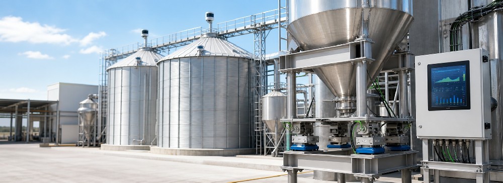
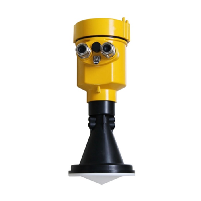

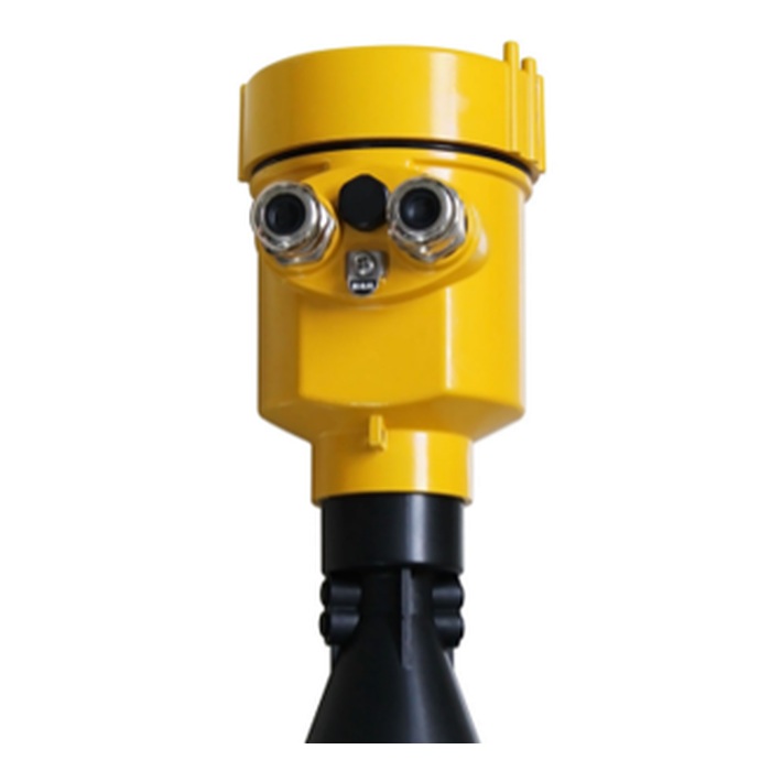
selection summary
Used for non-contact continuous water level measurement in rivers, lakes and shoals, reference range 0-30m, accuracy ±3mm, optional RS485 Modbus or 4-20mA/HART. Before ordering, you must also confirm the installation elevation, maximum and minimum water levels, protection, brackets, power supply and communication, lightning protection and whether flow calculation is required.
Product overview
MV-RD908S anti-corrosion 26 GHz radar water level meter is used for non-contact continuous water level measurement in open water bodies or municipal water affairs scenarios. The meter outputs distance or water level, which can be used for real-time monitoring, over-limit alarm and change trend analysis; it is not a radar flowmeter that alone completes flow calculation.
Measurement principle
The instrument uses 26 GHz microwave pulses to measure the propagation distance from the antenna to the water surface, and converts the water level based on the installation height. The non-contact method reduces the impact of water corrosion, sediment and floating objects on the sensor body.
Usage scenarios
- Continuous monitoring and over-limit alarm of water levels in small and medium-sized rivers, lakes and shoals.
- Non-contact water level measuring points under bridges, shore supports or hydrological station buildings.
- Scenarios where contact sensors require frequent maintenance due to sediment, floating objects and water corrosion.
- Projects that require access to RTU, PLC, Modbus acquisition system or remote hydrological platform.
Value applied to procurement and technicians
Technical parameters
| Typical applications | Water levels in rivers, lakes, shoals and channels |
|---|---|
| Measuring range | 0-30m |
| Measurement accuracy | ±3mm |
| Working frequency | 26 GHz |
| process connection | Gantry frame or locking flange, flange from DN80/3 inches |
| process temperature | -40~80℃ |
| process pressure | -0.1~0.3MPa; open water bodies are usually confirmed by normal pressure |
| Protection level | IP65 or IP67, depending on housing and complete configuration |
| Shell | Cast aluminum or plastic |
| Electricity | RS485 type DC6-24V; 4-20mA/HART type DC24V |
| Signal output | RS485 Modbus or 4-20mA/HART |
| Live display | Optional |
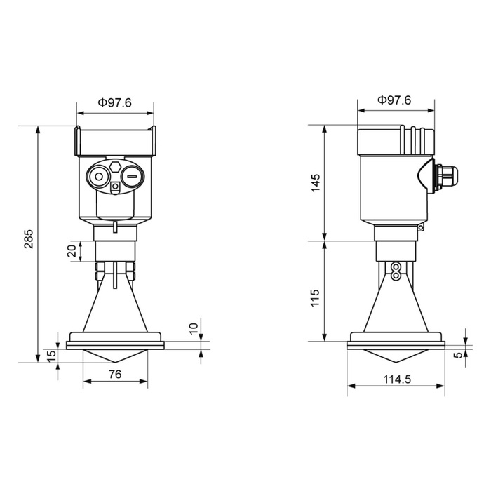
Description: The page parameters are used for inquiry and preliminary selection. The range, accuracy, protection, housing, power supply and output need to be confirmed according to the complete model combination. The upper limits of different configurations cannot be used at the same time by default.
Selection guide
- Provide the minimum water level, maximum water level, installation elevation and flood level, and select the range according to the maximum empty height instead of the normal water depth.
- Submit photos of river or lake survey points illustrating waves, foam, floating debris, drops, and fixed obstructions.
- Select the gantry frame, locking flange and maintenance direction according to the bridge, shore or station structure.
- Specify cast aluminum or plastic housing and confirm in writing whether the final protection level is IP65 or IP67.
- Select RS485 Modbus or 4-20mA/HART and check the power supply, communication and data acquisition platform interfaces.
- When flow is required, additionally confirm the flow rate, cross section, return water impact and water level-flow relationship maintenance method.
Key points for installation and commissioning
- The beam should illuminate the representative water surface vertically, avoiding the splash zone of bridge piers, shaft walls, steps and water outlets.
- The bracket must have sufficient stiffness. Vibration and tilt will cause the zero point of the water level to drift or the echo to change.
- Record the radar datum elevation and complete the initial comparison using a manual water gauge or known elevation points.
- Set up reasonable filtering to suppress waves while retaining the rapid water rise process, and alarm delays must not cover up risks.
- Outdoor power supply, communication, cable entry, lightning protection and grounding are designed uniformly according to the site system.
Related water level and flow products
FAQ
What scenarios is MV-RD908S suitable for?
Suitable for non-contact continuous monitoring of water levels in rivers, lakes, shoals and channels, and can be used for water level alarms and change trend collection.
What is the measuring range and accuracy of MV-RD908S?
The reference range of product specifications is 0-30m, and the reference accuracy is ±3mm. The 70m in the supplier's general introduction is the upper limit of the series and does not apply to this model.
Which one should be filled in between IP65 and IP67?
It must be confirmed according to the final shell and complete model. IP65 and IP67 cannot be regarded as having it at the same time. Quotes and contracts should state the actual selected level of protection.
Will the waves cause the water level to jump?
Waves will bring about instantaneous changes, which can be suppressed through reasonable filtering and averaging. However, excessive filtering will cover up rapid water rising. When commissioning, both stability and response speed must be taken into consideration.
How to convert river water level into flow?
The water level-flow relationship of the measuring point needs to be established and reviewed regularly; when backwater and erosion and siltation are obvious, the flow rate or upstream and downstream water level data should be added.
Can MV-RD908S measure flow directly?
Flow cannot be measured directly. It outputs distance or water level; flow also requires water measurement building formulas, water level-flow rate curves, or flow velocity and cross-sectional area data.
Will the radar water level gauge be affected by sediment and floating objects?
The sensor does not contact the water body, which can reduce sediment adhesion and floating objects entanglement, but large-area floating objects, waves and fixed obstacles may still form abnormal echoes.
How to connect radar water level meter to RTU or PLC?
RS485 Modbus or 4-20mA/HART available. Before connecting, the power supply, station number, baud rate, range, fault value, sampling period and grounding must be unified.
Why must the base elevation be recorded during installation?
The instrument first measures the altitude. Only by knowing the elevation of the radar datum can the water level and elevation be stably converted and the same data datum restored after maintenance and replacement.
What information do I need to provide to inquire about MV-RD908S?
Please provide the minimum and maximum water levels, installation elevation, site photos, sections and obstacles, temperature, protection, power supply and communication, lightning protection, platform interface and whether flow calculation is required.
Ordering instructions
When ordering, please provide the minimum and maximum water levels, radar installation base elevation, site and section photos, waves and floating objects, brackets and process connections, protection and temperature, power supply and communication, lightning protection grounding, platform protocol, alarm purpose and whether flow calculation is required. The final parameters are subject to the written selection confirmation and order drawing.